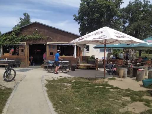
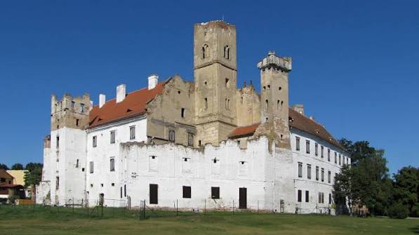
START – BŘECLAV CASTLE
Břeclav Castle is originally a renaissance building built on the foundations of a medieval border castle, which was radically rebuilt by the Liechtenstein family in the 19th century into a romantic artificial ruin. The castle is located on the Castle Square on the outskirts of the town of Břeclav near a branch of Dyje River. Entire area is currently undergoing extensive reconstruction, due to which the main castle building is inaccessible to the public. Only the castle observation tower and the wine cellar in the castle cellars are open to visitors.
WP location: Start of UB30 from area between castle and Cyklosféra club
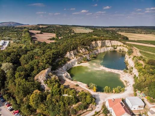
WP 2 JANIČŮV VRCH QUARRY
Janičův vrch is a flooded limestone quarry located in the immediate vicinity of Mikulov. Since 2014 it has been declared a natural monument
WP location: Upper lookout point at the quarry, approx. 300m along the MTB trail with a short push.
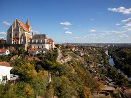
WP 3 ZNOJMO – ROTUNDA OF ST. CATHERINE
The rotunda of St. Catherine in Znojmo is a national cultural monument from 11th century, which represents the only fully preserved remnant of a Přemyslid princely castle. It is unique in Europe thanks to its interior fresco painting from 1134, which depicts the oldest preserved portrait gallery of Přemyslid monarchs in the Czech lands.
The viewpoint at the rotunda of St. Catherine in the Znojmo Castle area offers one of the most beautiful and iconic views of the city of Znojmo. From the terrace right next to the Romanesque rotunda you will see the deep valley of the Dyje River, the impressive church of St. Nicholas and the historic center of the city
WP location: Stone wall at the rotunda
WP 4 ČÍŽOV – FORMER WATCHTOWER
The former watchtower in Čížov is the only preserved watchtower and an authentic remnant of the Iron Curtain in the Czech Republic. This tower served the Border Guard to monitor the state border with Austria and to prevent citizens from escaping from then socialist Czechoslovakia.
WP location: Under the watchtower

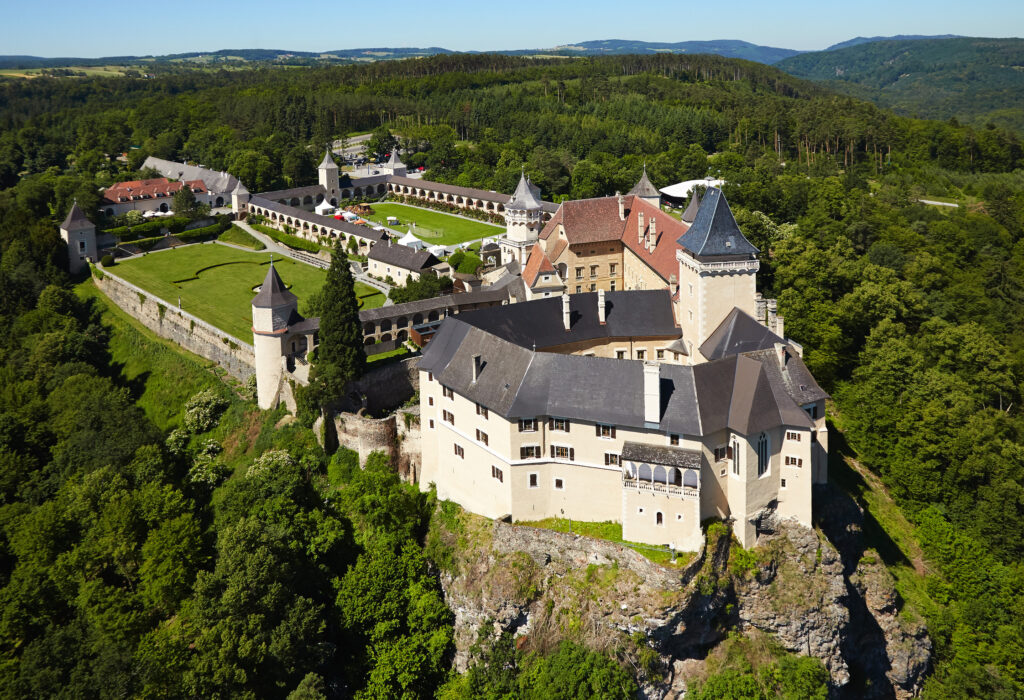
WP 5 ROSENBURG CASTLE
Rosenburg Castle is one of the most important and beautiful Renaissance castles in Austria. It is located in Lower Austria on a steep rock above the romantic Kamp River valley, near the town of Horn. Originally a Romanesque castle from the 12th century, it was rebuilt in the 16th century into a magnificent Renaissance residence with 13 towers and one of the largest tournament courts in Europe.
Location of WP: entrance gate to the castle
WP 6 JAUERLING LOOKOUT TOWER
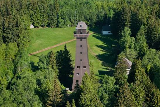
The Jauerling lookout tower (Aussichtswarte Jauerling) is a 38-meter-high lookout tower located on the southern peak of the Burgstock of the Jauerling mountain of the same name in Austrian region Wachau at an altitude of 960 meters above sea level. It is the highest point in the entire Danube Valley.
The structure is made of concrete and wood, with 187 steps leading to the top platform. The current tower was built between 1984 and 1991. Since 1998, a permanent exhibition of minerals has been located inside the tower.
Location of WP: under lookout tower
WP 7 MELK
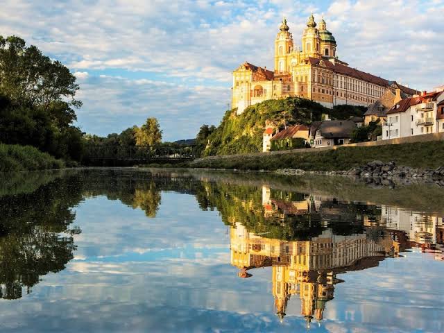
The Melk Monastery (Stift Melk) is an impressive Benedictine abbey and one of the most important Baroque buildings in Europe, which rises on a rocky promontory above the Danube River in the Lower Austrian town of Melk. This monumental complex is listed as part of the UNESCO World Heritage Site of the Wachau Valley. It serves as a spiritual and cultural center where Benedictine monks have lived and worked continuously since 1089.
The main attractions of the monastery include the library (keeping over 100,000 rare medieval volumes and manuscripts), the Monastery Church of St. Peter and Paul, the Marble Hall and the Monastery Park. The premises are home to the oldest still functioning school in Austria
WP Location: The best panoramic view of the Baroque Melk Monastery opens from the St. Leopold Bridge, which spans the arm of the river below the monastery rock. From here, you can take iconic photos of the monumental front facade of the church, which is beautifully reflected in the water surface in calm weather
WP 8 ST. POLTEN
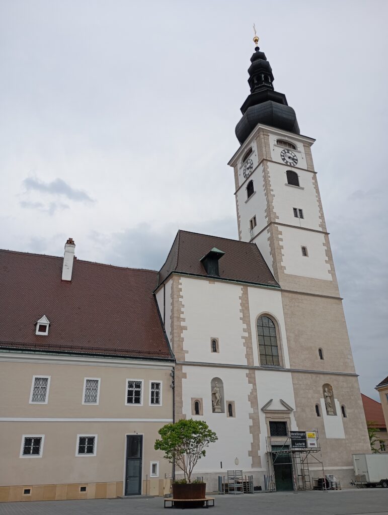
St. Pölten is the capital and largest city of Lower Austria. It is located on Traisen River, approximately 60 km west of Vienna, and has a population of approximately 57,000. It is considered the oldest documented city in Austria. The city combines historic Baroque architecture with ambitious modern design in a unique way.
The elegant Baroque Rathausplatz is its historical and cultural center, forms the core of the second oldest pedestrian zone in Austria and is the main starting point for tourists.
Main sights: Historic Town Hall, Holy Trinity Column (Dreifaltigkeitssäule, from 1782 decorated with a marble fountain and a more than 20-meter-high cloud spiral) and Franciscan Church (Franziskanerkirche).
WP location: Rathausplatz, in front of the town hall.
WP 9 SCHÖPFL – MATRASWARTE OBSERVATION TOWER
The Matraswarte is a 17-meter-high steel observation tower that stands directly on the summit of Schöpfl mountain (893m). Schöpfl is a highest peak in entire Vienna Woods (Wienerwald) in Lower Austria
WP location: under the observation tower

WP 10 VIENNA
Vienna (Wien) is the capital and largest city of Austria, located on Danube River and has long been ranked among the cities with the highest quality of life in the world. As the former center of the Habsburg monarchy, it offers a rich history, imperial architecture, world-famous museums and a unique café culture.
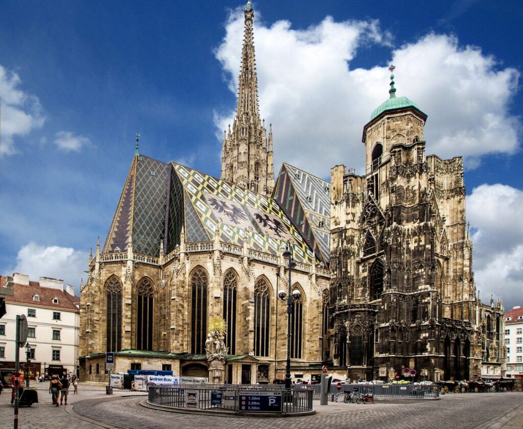
The fixed route through the historic center will take you past the biggest attractions such as Schönbrunn Palace, St. Stephen’s Cathedral (Stephansdom), Hofburg Palace, or the Prater amusement park with its iconic Giant Ferris Wheel (Riesenrad)
WP location: Fixed route
WP 11 KAMZÍK
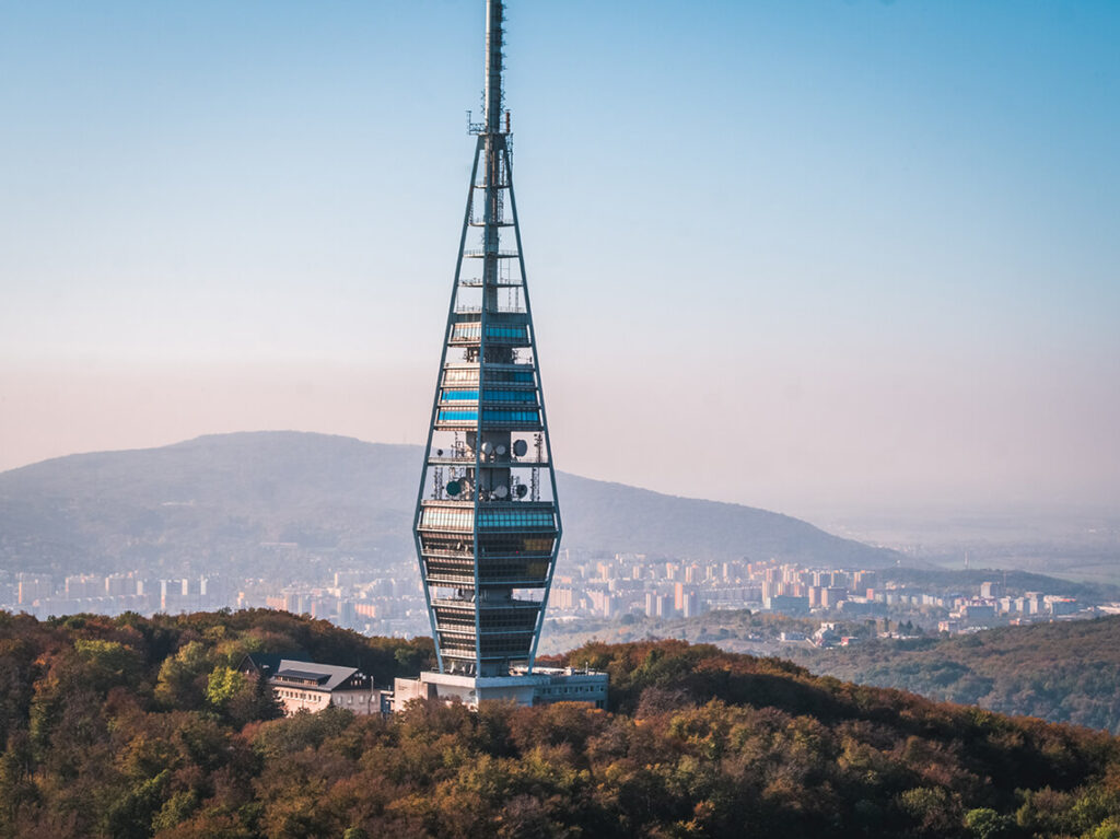
The Kamzík television tower is one of the main landmarks of Bratislava, rising to a height of 196 meters on the hill of the same name in the Bratislava Forest Park. It combines the functions of a television transmitter, an observation tower and the Altitude restaurant with a unique rotating platform and a panoramic 360° view at a height of 68 meters above the ground. The observation platform offers a view of neighboring Austria, Hungary and the Czech Republic in good visibility.
The tower was completed in 1975 according to the design of a team of architects (S. Májek, J. Tomašák, J. Kozák, M. Jurica and J. Privitzer). Its shape resembles two connected four-sided pyramids.
WP location: under the television tower
WP 12 M.R. ŠTEFÁNIK MOUND
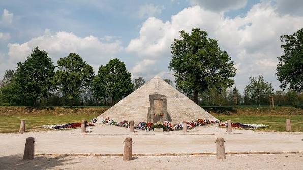
The mound of General M. R. Štefánik is a stone monument in the cadastre of the municipality of Most pri Bratislave, near Bratislava airport. It commemorates the tragic death of the general and the Italian crew in a plane crash on May 4, 1919. The unique pyramid-shaped structure was designed by architect Dušan Jurkovič and was completed in 1923. The granite mound stands in a quiet park surrounded by linden trees at the authentic crash site.
WP location: in the middle of the park in front of the mound
WP 13 GABČÍKOVO
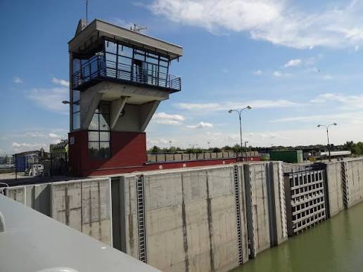
The Gabčíkovo Dam is the largest water structure in Slovakia built on the Danube River. Its main dam with a hydroelectric power plant and lock chambers is located approximately 1 km south of the town of the same name, Gabčíkovo. It was originally built in 1976 as a joint Czechoslovak-Hungarian project. After Hungary’s unilateral withdrawal, Slovakia completed it on its own and fully commissioned it in 1992.
The dam and its technological facilities form a monumental technical complex that ensures flood protection, clean energy production and smooth shipping. The height of the dam is 36.6 meters and the length reaches 1,423 meters. The width of the dam’s crown is 13 meters
WP location: dam of the waterworks
WP 14 GYÖR
Győr is the eighth largest Hungarian city, located in the northwest of the country, halfway between Vienna and Budapest. It has about 130,000 inhabitants and is the administrative center of Győr-Moson-Sopron County. Due to its location at the confluence of the Moson Danube, Rába and Rábca rivers, it is nicknamed the „city of rivers“. The city stands out for its beautiful Baroque historic center and modern thermal water park.
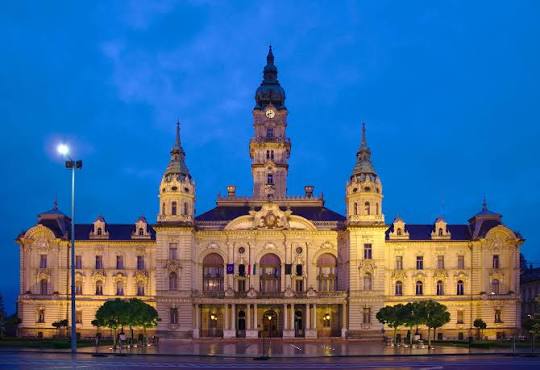
The Győr Town Hall (Városháza) is an eclectic and neo-Baroque building from 1896–1898, which forms the main landmark and symbol of the northern Hungarian city of Győr. It stands on Városház tér square. The two-story palace is built in a U-shape. The main facade is decorated with a 59-meter-high central tower complemented by two smaller side towers
WP location: in front of the town hall
WP 15 PANNONHALMA
The Pannonhalma Archabbey is the oldest functioning Benedictine monastery in Hungary, founded in 996. This complex stands on the Holy Hill of Pannonia (Szent Márton Hill) and has been on the UNESCO list since 1996. It currently serves as a spiritual center, a boys‘ grammar school and a popular tourist destination. The library contains over 400,000 historical volumes and is one of the largest church libraries in Europe. It preserves the founding charter of the Tihany Abbey from 1055, which contains the oldest written Hungarian words.
WP location: abbey courtyard, gate to the courtyard at night

WP 16 HUBERTLAKI LAKE
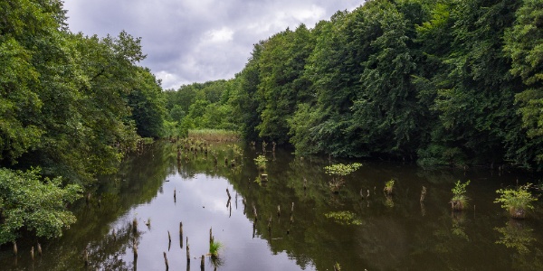
Lake Hubertlaki-tó is nicknamed the Lake of the Murderers (Bakonyi Gyilkos-tó) because of the remains of drowned trees protruding above the surface. It is located in the deep forests of the Bakony Mountains, about 15 km from the village of Bakonybél. It was created in the 1980s by damming a stream. It is named after a defunct settlement and former hunting lodge of the Esterházy family (Hubertlak), which burned down in a fire in 1967. Dozens of dried-up tree trunks and stumps protrude from the water surface, which strongly resembles the more famous Romanian Lake Lacul. Nearby is a monument to Saint Hubert (patron saint of hunters) and primeval forest scenery.
WP location: lake shore
WP 17 KAB HÉGY – PÁL KINIZSI LOOKOUT TOWER
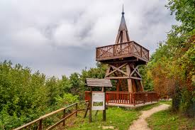
The Pál Kinizsi Lookout Tower (Kinizsi Pál-kilátó) is located on the top of Kab-hegy hill at an altitude of 599m and is the highest point of the South Bakony Uplands. This wooden lookout tower was built in 2013 from pine wood and offers a unique view of the Balaton Highlands, the Vázsony Basin and Lake Balaton itself
WP location: observation deck of the lookout tower
WP 18 VESZPRÉM
Veszprém is one of the oldest and most beautiful Hungarian cities, known as the “city of queens” because it was the residence and coronation place of Hungarian monarchs in the past. It is located in western Hungary on seven hills in the foothills of the Bakony Forest, approximately 15 km north of Lake Balaton and 110 km from Budapest. The city with a rich history, which proudly bore the title of European Capital of Culture in 2023, enchants with its romantic streets, Baroque architecture and the picturesque valley of the Séd River.
The main sights and attractions include the Castle District (a preserved historical complex on a rocky promontory, entered through the impressive Heroes‘ Gate), St. Michael’s Cathedral, the 48m high Fire Tower (Tűztorony) with an observation deck, and the Archbishop’s Palace, which houses rare frescoes and an extensive library. The bronze statue of St. Stephen and Queen Gisela stands on a viewpoint at the southern end of the Castle Hill in the city of Veszprém. The work by sculptor József Ispánky from 1938 is a symbol of the city and commemorates the founder of the Hungarian state and Christianity. It was created by sculptor József Ispánky in 1938 for the 900th anniversary of the death of St. Stephen. The site offers a panoramic view of part of the city and the Bakony Mountains. Symbolism of the statue – St. Stephen holds a sword in his hand as a symbol of power and an apple, Queen Gisela holds a model of a church with two towers, which commemorates her contribution to the foundation of the Veszprém Cathedral
WP location: viewpoint by the statue of St. Stephen and Gisela of Bavaria

WP 19 ZSIGMOND SZÉCHENYI LOOKOUT TOWER
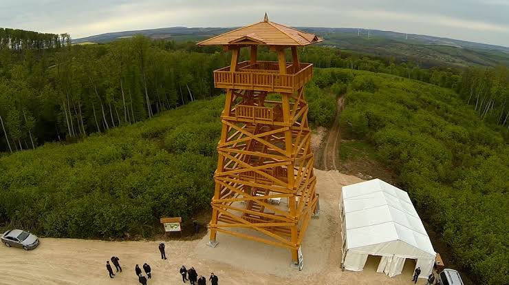
The wooden Count Zsigmond Széchenyi Lookout Tower (Gróf Széchenyi Zsigmond-kilátó) is located on the northern edge of the plateau near the Hungarian village of Tés in the Bakony Mountains.
The structure measures exactly 18.48 meters – the height refers to the significant year 1848, when the revolution for independence broke out in Hungary. From the landing at a height of 15 meters, a view of the rolling landscape of the Bakony opens. The horizon is dominated by modern wind turbines near the villages of Szápár and Csetény. In exceptionally good visibility, the distant Pannonhalma Archbishopric can also be seen. The building bears the name of the famous Hungarian traveler, writer and hunter Zsigmond Széchenyi. He caught his first deer in the surrounding forests as a young man
WP location: under the lookout tower
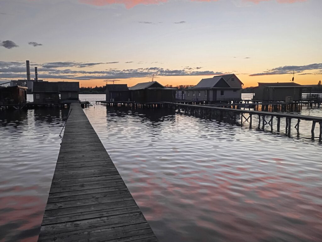
WP 20 FLOATING HOUSES ON LAKE BOKOD
The floating houses on Lake Bokod are a unique fishing settlement that has become famous as a photogenic “floating village”. Colorful wooden huts built on wooden stilts directly above the water surface are connected to the mainland by long, narrow wooden piers. The site is located approximately 80 kilometers west of Budapest, on the border of the municipalities of Bokod and Oroszlány.
Lake Bokodi is an artificial cooling reservoir built in 1961 by the nearby Oroszlány coal-fired power plant. The power plant has been releasing warm water into the lake for decades. Thanks to this constant heat circulation, the lake has never frozen over, even in the harshest winters. This has allowed local fishermen to fish all year round without having to cut through the ice. In 2015, the power plant was ended, since then the water has not been artificially heated and the lake freezes normally in the winter months
WP location: one of the easily accessible wooden piers
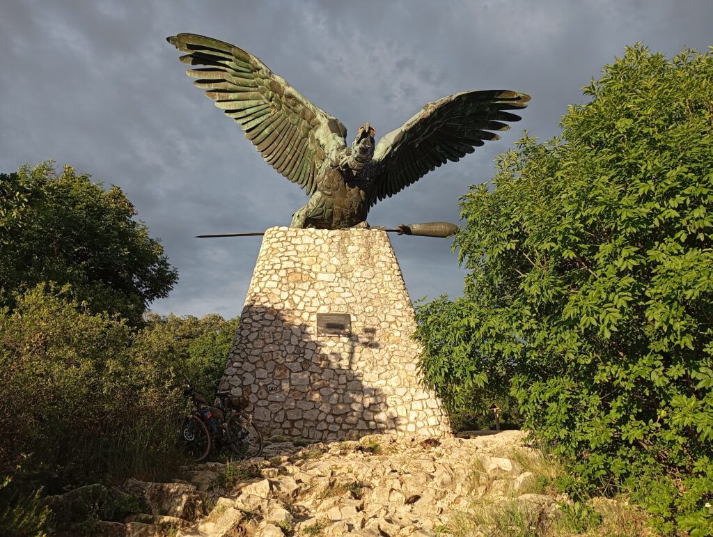
WP 21 TATABÁNYA – STATUE OF BAHHID TURUL
The statue of the Bahhid Turul in the Hungarian city of Tatabánya is the largest statue of a bird of prey in Europe. The monumental bronze colossus with a wingspan of almost 15 meters rises on the limestone cliff of the Kő-hegy mountain at an altitude of 340 m above sea level, from where it guards the entire surroundings and is perfectly visible even from the M1 motorway leading from Vienna to Budapest.
The monument was designed by sculptor Gyula Donáth to celebrate the millennium of the arrival of the Hungarians in the Carpathian Basin. Due to lack of funds, it was not completed and ceremonially unveiled until 1907. The Turul is a mythical predator (resembling an eagle or falcon) from Hungarian pagan legends. According to legend, it led the nomadic Hungarian tribes to their new homeland and showed them a place to settle. The statue stands near the battlefield of the historic Battle of Bánhida, where, according to legend, Árpád defeated the Great Moravian prince Svatopluk. The monument survived attempts to destroy it by the communists in 1919 and plans to dismantle it in the 1950s. In 1992 and then in 2026, it underwent extensive restoration
WP location: view of Tatabánya under the Turul statue
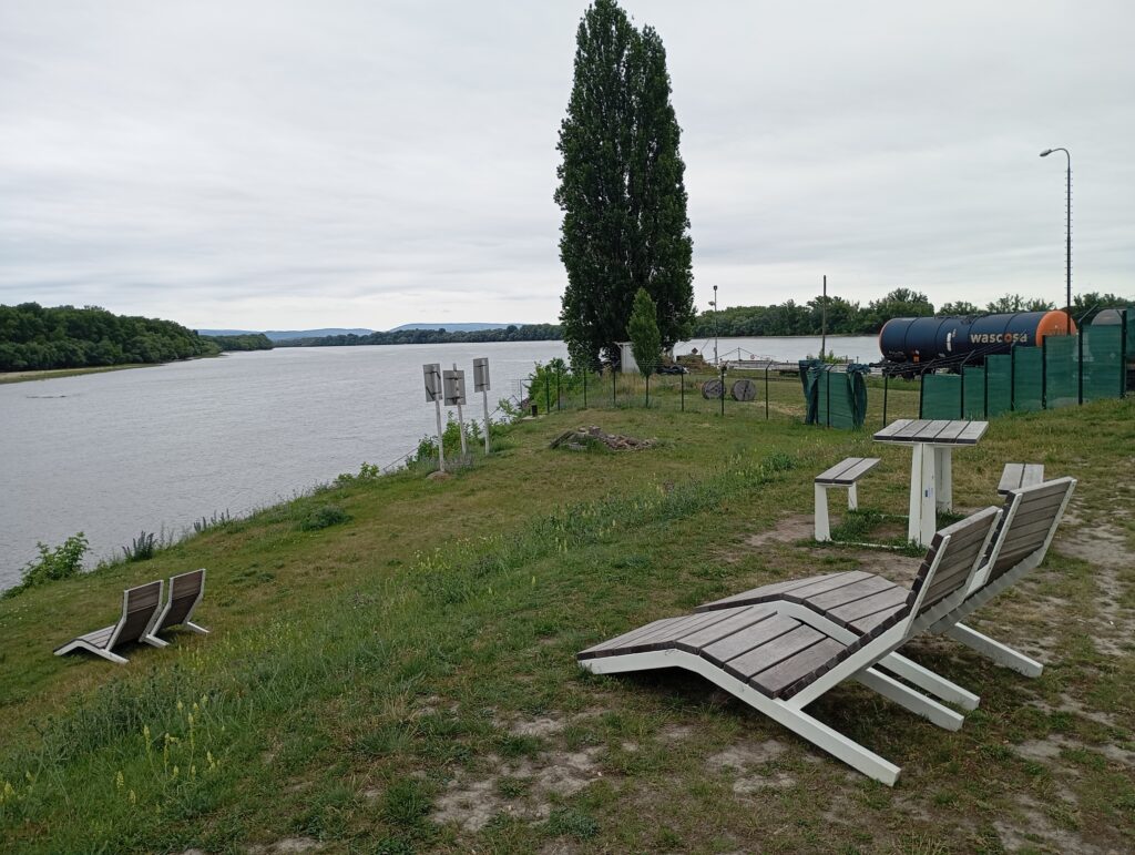
WP 22 CONFLUENCE OF VÁH AND DANUBE
The confluence of the Váh and Danube is located in southern Slovakia near the city of Komárno. The Váh is the longest Slovak river and here it gives its waters to the second longest river in Europe. Here the Váh ends its approximately 351-kilometer journey from its source in the Tatra Mountains. Immediately at the confluence is the extensive Komárno Fortress, which is the largest fortress system in Central Europe
WP location: relaxation loungers with view of the confluence
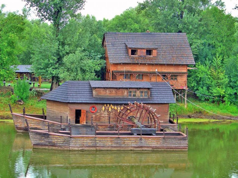
WP 23 WATER MILL KOLÁROVO
The water mill Kolárovo is a unique national cultural monument of Slovakia, located in the southwest of the country near the town of Kolárovo, on the dead arm of the Little Danube and the Váh. It is the last floating mill in Slovakia and the only preserved specimen of this type.
The mill is built on two parallel boats, between which there is a paddle mill wheel. The current building is a faithful functional replica from 1982, built according to the model of the historical mill from Radvan nad Dunajom. The wheel does not turn today only because the arm of the river has stagnant water.
The iconic dominant of the entire area leads to the pedestrian mill itself – the 86-meter-long and 2.5-meter-wide acacia wood bridge is the longest all-wooden covered bridge in Europe and completes the very photogenic atmosphere of this place.
WP location: inside wooden bridge
WP 24 KRÁĹOVÁ
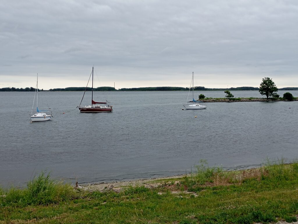
Kráĺová water body (often also called the Cascades) is a multipurpose water reservoir in southern Slovakia, which extends on the Váh River between the towns of Sereď and Šaľa. The reservoir was completed in 1985 and is part of the extensive Váh Cascade system. It serves energy purposes, flood protection, irrigation and is a very popular center for recreation and water sports
WP location: point on the cycle path near the hydroelectric power plant
WP 25 SMOLENICE CASTLE
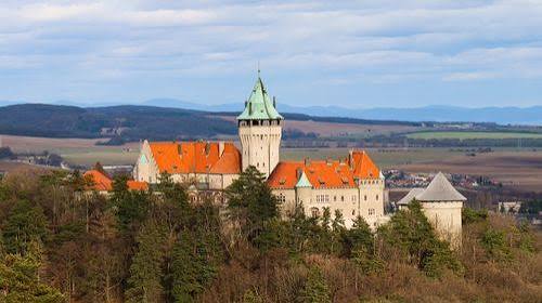
Smolenice Castle is a romantic landmark at the foot of the Little Carpathians located above the village of Smolenice in the Trnava District. It is the youngest castle in Slovakia, which was completed in its current form only in 1953. Today it serves as a representative and congress center of the Slovak Academy of Sciences (SAV) and is open to the public as part of guided tours.
Originally, a medieval guard castle had stood on its site since the 14th century, protecting the so-called Czech Road. At the beginning of the 19th century, the castle burned down during the Napoleonic Wars, leaving only ruins. The last owners, the Pálffy family, began building a new castle at the end of the 19th century. The architect Jozef Hubert was inspired by the appearance of medieval castles (especially the Austrian Kreuzenstein). Construction was interrupted by the world wars, and it was only completed by the state after 1945
WP location: entrance gate to the castle
WP 26 RUINS OF THE CHURCH OF ST. CATHERINE OF ALEXANDRIA
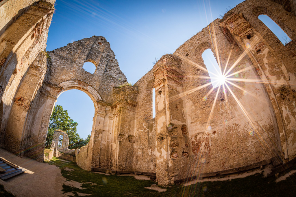
The ruins of the church and monastery of St. Catherine of Alexandria, known as Katarínka, are an impressive Baroque Franciscan complex from the 17th century. It is located in the forests of the Little Carpathians in Slovakia, between the villages of Naháč and Dechtice, near Trnava. The place is surrounded by legends of apparitions and is now looked after by volunteers. The church was founded in 1618 on the site of an older chapel, then abolished by the decision of Charles II of Habsburg in 1786. The preserved ruins with a restored tower now serve as a lookout tower
WP location: inside the church
WP 27 BRADLO
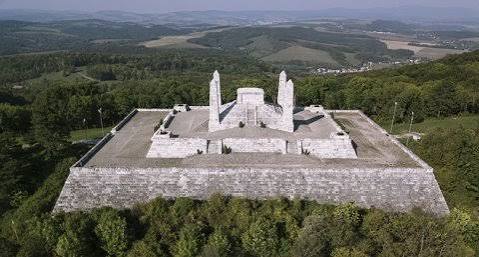
The M.R. Štefánik’s mound on Bradlo Hill (543 m above sea level) in the Myjavská pahorkatina in Slovakia is the tomb of the general, astronomer and politician Milan Rastislav Štefánik and two Italian pilots who died with him in a plane crash in 1919. The building was designed by architect Dušan Jurkovič and was built in 1927–1928 from travertine. It offers a wide view of the region.
WP location: under the steps of the mound
WP 28 VELKÁ JAVOŘINA
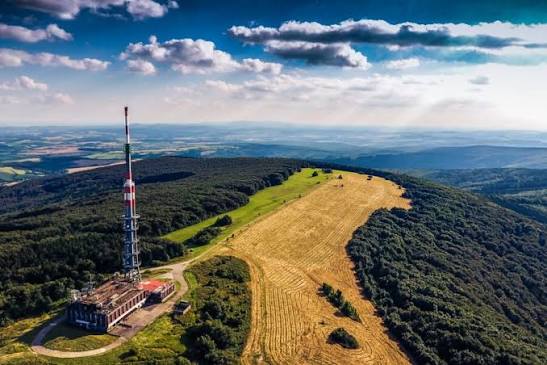
Velká Javořina is, with its 970 m above sea level, the highest mountain in the White Carpathians. The state border between the Czech Republic and Slovakia passes through the peak. The mountain serves as a traditional symbol of friendship between the two nations. The unmistakable dominant feature of the peak is the transmitter, which provides television and radio signals for the wider area.
On the northern slopes of the mountain lies the original maple-beech forest with protected fauna and flora. A little below the peak is the Holuby cottage on the Slovak side, which offers accommodation and a restaurant.
WP location: under the transmitter
WP29 KUŽELOV
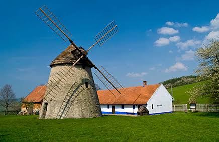
The windmill in Kuželov is one of the most important and best preserved technical monuments of its kind in the Czech Republic. This national cultural monument, built in 1842, is located on the unforested ridge of the White Carpathians above the village of Kuželov in the Moravian Slovácko (Horňácko) region. The mill is fully functional and is managed by the Technical Museum in Brno.
It is a Dutch-type mill – a brick conical structure, where only the wooden shingle roof with a four-winged windmill rotates according to the wind. Inside is a complete preserved milling equipment with the so-called Czech composition. An exhibition of Horňák housing and agriculture from the turn of the 19th and 20th centuries is installed in the adjacent residential and farm buildings.
Location of WP: entrance gate to the mill by the parking lot
WP 30 HRADIŠTĚK
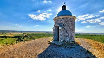
The Chapel of St. Cyril and Methodius, Wenceslas and Urban stands on a prominent hill of Hradištěk (also known as Zímarky) at an altitude of 262 m above sea level in the middle of rolling vineyards near Velké Bílovice. This iconic building in the shape of a Romanesque rotunda is one of the most photographed places in South Moravia.
WP location: viewpoint behind the chapel
WP31 LEDNICE CHATEAU
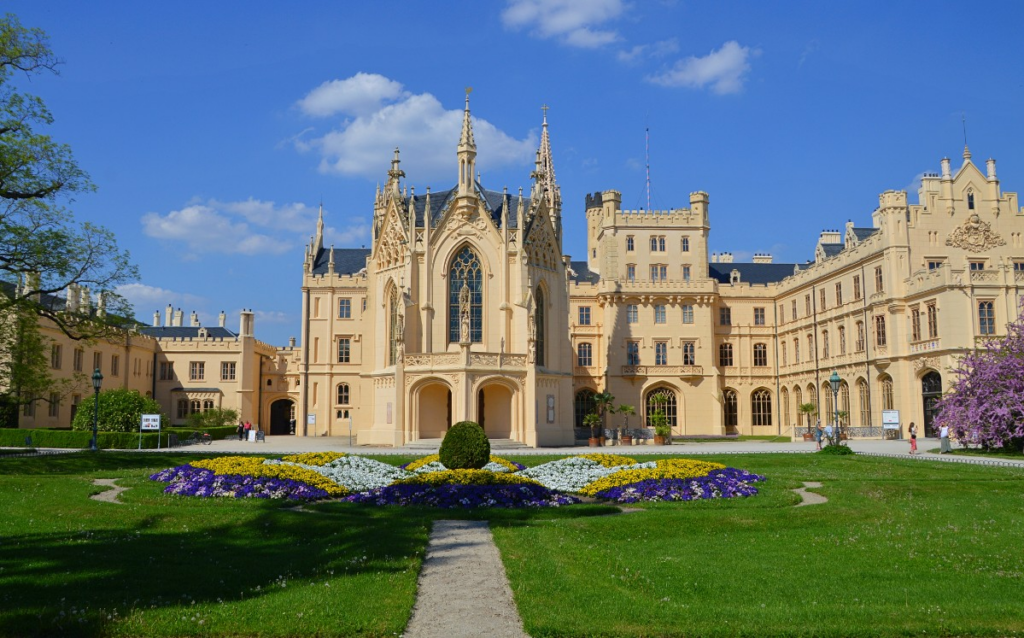
The Lednice State Chateau is one of the most beautiful and most visited architectural complexes in the Czech Republic. This neo-Gothic gem is located in the South Moravian Region and is part of the Lednice-Valtice Area, which is a UNESCO World Heritage Site. Originally a Gothic fortress, it was rebuilt by the Liechtenstein family into a luxurious residence with unique carved interiors. The area includes an impressive palm greenhouse from 1843–1845 with tropical and subtropical flora, an English park interwoven with water canals, a 60m high Minaret, and the hunting lodge Janův hrad.
WP location: main entrance to the castle
FINISH – CYKLOSFÉRA BŘECLAV
Cyklosféra Břeclav is a popular restaurant, sports and relaxation area and cycling hub, located in close proximity to the Břeclav castle. It serves as an ideal base for families with children, tourists and cyclists passing through the Lednice-Valtice area. Since 2022, it has served as the finish line of the bikepacking MTB race Moravia Divide, the largest event of the UltraBikers Cup.